Muncy, PA
+1 (570) 368-39207am–7pm ET (M–F), 9am–5pm ET (Weekend)10AM—6PM ET

Garmin
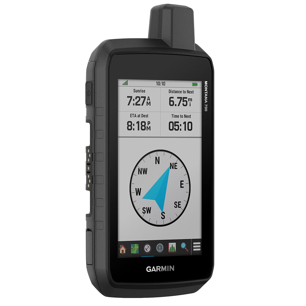
Dominate the backwoods with the Montana 700 GPS Navigator by Garmin! This durable GPS is equipped with Multi-GNSS support providing access to GPS, GLONASS, and Galileo satellite systems, and comes preloaded with TopoActive maps of the U.S. and Canada which displays information regarding terrain contours, elevations, coastlines, rivers, landmarks, and other points of interest. The Montana 700 also comes with an optional display of federal public land boundaries on topographical maps, and direct-to-device downloads of BirdsEye Satellite Imagery for photo-realistic views and lets you create waypoints based on landmarks. Other wayfinding abilities include 16 GB of onboard memory and a microSD card slot for downloading additional maps such as City Navigator. The Montana 700 also comes equipped with ABC sensors including an altimeter, a barometer, and 3-axis compass to help you navigate difficult terrain. Whould you bring your four-legged friends on your adventure, the Montana 700 can sync up with compatible Garmin dog training collars such as the Astro and Alpha for tracking and retrieving your dogs in the field.
010-02133-00-Garmin
753759215002
010-02133-00
Add all 0 items in this product bundle to your cart with one click.