Muncy, PA
+1 (570) 368-39207am–7pm ET (M–F), 9am–5pm ET (Weekend)10AM—6PM ET

Garmin
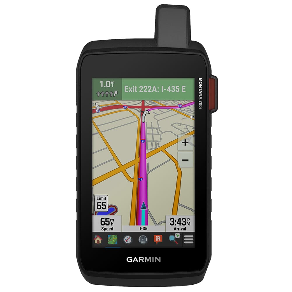
Dominate the backcountry with the Montana 700i GPS Navigator by Garmin! It comes equipped with Multi-GNSS support, giving the user access to both GPS and Galileo satellite networks for reliable tracking in challenging environments. The Montana 700i also features a wide array of preloaded topographical maps for the U.S. and Canada to provide information about terrain contours, elevation, coastlines, rivers, and other landmarks. For more photo-realistic views, the operator can use direct-to-device downloads of BirdsEye Satellite Imagery and create landmark based waypoints. The Montana 700i’s other navigational features include optional displays of federal public land boundaries on topographical maps, as well as 16 GB of internal memory and a microSD card slot for downloading additional maps. If your adventure is a little closer to civilization, the Montana 700i features Garmin’s own City Navigator for a seamless transition from trails to streets with easy to follow turn-by-turn directions.
In addition to its impressive navigational functions, the Montana 700i is outfitted with a multitude of other features specifically tailored to individuals with active outdoor lifestyles. To keep in touch while you’re off the grid, the Montana 700i comes with two-way messaging to send text messages to family and friends, post to social media, and communicate with other select Garmin GPS Navigators/Communicators. Should an emergency situation arise, the Montana 700i can issue an SOS message GEOS – a Garmin-powered International Emergency Response Coordination Center (IERCC) with professional 24/7 global monitoring and response center. Both the two-way messaging and SOS functions require a subscription to the inReach satellite network, click here to get started). Should you bring your four-legged friends with you on your adventure, the Montana 700i can sync up to Garmin’s Astro and Alpha dog training collars to track and retrieve your sporting dogs in the field.
Note: Some features such as the Two-Way Messaging and Interactive SOS require an active subscription to the inReach satellite network, click here to get started
Add all 0 items in this product bundle to your cart with one click.
010-02347-10-Garmin
753759257736
010-02347-10


